Yuxu Palace at Wudang Mountain: Imperial Ruins and Administrative Centre
武当山玉虚宫:明代皇家遗址与全山管理中心
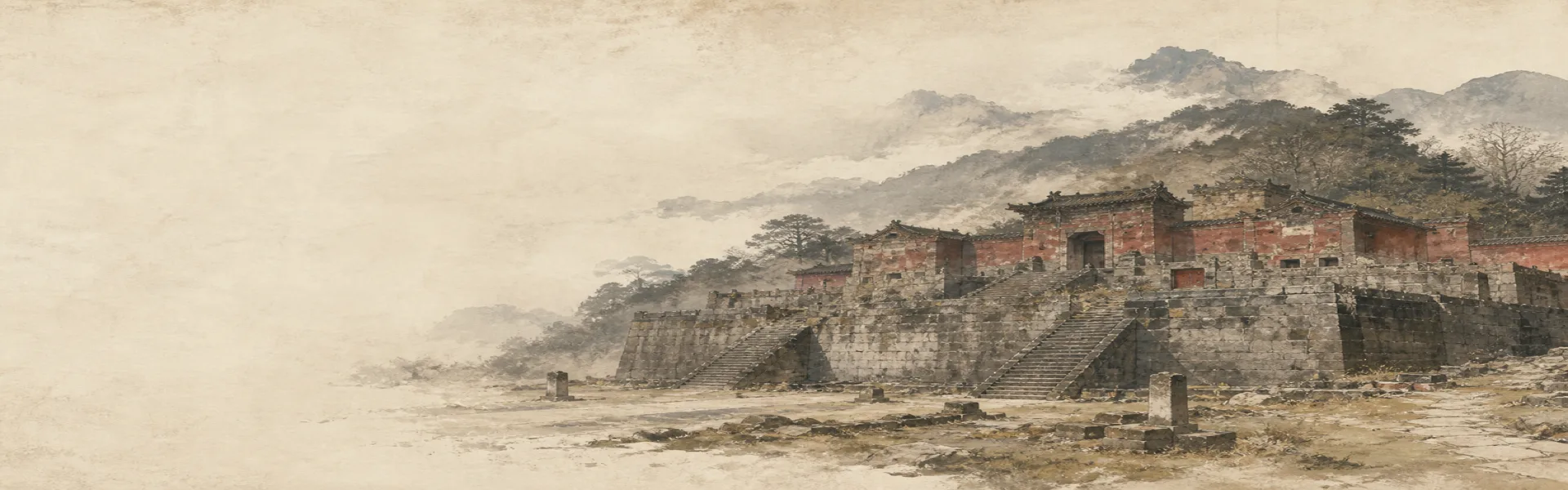
Yuxu Palace occupies flat ground near the foot of the mountain. It was built during the Yongle programme and was, by ground area, the largest complex on Wudang — larger than anything on the central route, including the summit. Today it is substantially a ruin, and that is precisely what makes it one of the most instructive places on the mountain.
What it was for
Yuxu was the administrative centre of the whole enterprise, and understanding that explains everything else about it, including why it is where it is.
A religious mountain on this scale needed an office. This was it: the place from which the entire system of palaces, temples, hermitages and cliff shrines was managed, supplied and staffed. Pilgrims arriving from the river landing came here first. Clergy assigned to the mountain were registered and allocated from here. Imperial envoys and supervising officials were housed here. Grain, timber, cloth, ritual materials and money passed through here. Records were kept here.
This is why the largest building group sits at the bottom of the mountain rather than the top, which surprises visitors who assume that height tracks importance. In administrative terms the reverse is often true: the innermost hall of a cult may be small, while the office that runs it must be large. The summit holds a bronze hall a few metres across; Yuxu held the bureaucracy.
The name itself, referring to a jade void associated in Taoist cosmology with the highest of the Three Pure Ones, was a grand one, and it was matched to the grandest footprint on the mountain.
The scale, and a saying about it
Traditional accounts credit the complex with well over two thousand bays of building, enclosed by concentric walls of considerable extent. Whether or not the figure is exact, the footprint on the ground supports the general claim: this was a walled institutional town rather than a temple.
There is a saying often quoted about the Yongle era to the effect that in the north they built the Forbidden City and in the south they built Wudang. It is repeated as local pride, but it is also close to literally true as a statement about resources: the same reign, the same treasury and much the same administrative machinery produced both, and Yuxu is where that machinery was housed. Standing in the outer enclosure, the comparison stops sounding like boosterism.
The concentric arrangement is worth registering. Chinese institutional planning expresses importance through layers of enclosure, so that reaching the centre means passing through a sequence of increasingly restricted zones. At Yuxu you can still walk that sequence, and because the buildings are gone you can see the whole diagram at once rather than piece by piece.
What happened to it
Fire in the eighteenth century destroyed much of the complex, and flooding and neglect finished a good deal of the rest. For most of the modern period Yuxu was a ruin field: platforms, column bases, paved surfaces, gate foundations and stele pavilions standing in open ground.
The causes are worth naming because they are the standard causes on this mountain. Timber burns, and a dense complex with lamps and incense in it burns comprehensively. Flat ground near a river floods. And a building stock designed for imperial funding cannot be maintained once that funding stops, which it did under the Qing when dynastic attention moved elsewhere. Yuxu did not fall to any dramatic event; it fell to the ordinary arithmetic of maintenance.
Substantial restoration and archaeological work has been carried out since the late 2000s, so what you see now is a mixture of consolidated ruin, reconstructed gates and walls, and open excavated ground.
Restoration and the visible joins
That mixture is itself informative, because the joins are visible. You can see where new stone meets old, which is a rare opportunity and a genuinely useful education.
Look at colour, at surface texture and at tooling. Old dressed stone is weathered, discoloured unevenly, and shows hand-tool marks; new stone is uniform in colour and often shows the regular striations of machine cutting. Old mortar and new mortar differ. Where a wall has been rebuilt on an original base, the change is usually plain once you know to look at the horizontal line where the two meet.
Current conservation practice generally favours making interventions legible rather than seamless, on the principle that a visitor should be able to distinguish evidence from interpretation. Yuxu is one of the best places on the mountain to see that principle applied, and having learned to read it here you will read the central route much more accurately.
Reading the ground plan
This is the main reason to come, and it rewards slow walking rather than photography.
Start on the central axis and walk its full length, noting how far you travel and how many thresholds you cross. Look at column bases: their diameter indicates the size of the timbers that stood on them, and the spacing between them gives you the bay width, which is a direct index of a building's rank. Count bays along a platform to work out the width of a lost hall. Look for drainage channels and culverts, because water management on flat ground was the real engineering problem here, and the provision is often better preserved than anything above it. Notice gate foundations and the lines of walls, which tell you where the enclosure boundaries ran.
Then do the imaginative work. Stand on an empty platform and reconstruct the hall that stood there from its footprint and the height of its base. A visitor who does this for half an hour understands Chinese architectural planning better than one who has walked through a dozen standing halls.
The steles
Among the most important things on the site are the great stone steles, several of them carrying Ming imperial texts, housed in pavilions and carried on massive stone animals.
These are primary documents. They record the orders that authorised the works, the endowments assigned, the titles granted and the reasons the court gave for what it was doing. Reading them, or reading translations of them, is as close as you will get to hearing the Ming government explain the mountain in its own words rather than through later interpretation. Their survival is also typical: stone endures while the halls around it burn, which is why the documentary record of this site is better preserved than the site itself.
The stele pavilions are worth attention too, because several were reconstructed and they show what the conservation approach looks like when applied to a whole building rather than a wall.
Why it is worth going
Four reasons, in descending order of strength.
It is the clearest lesson in Chinese architectural planning available on this mountain, because the plan is exposed. It is the place where the administrative reality of a state-sponsored cult becomes concrete, which corrects a purely spiritual picture of Taoism more effectively than any text. It is quiet, and it is close to the foot of the range, so it costs less effort than any other significant site. And it makes the scale of the Ming enterprise comprehensible in a way the summit does not, because the summit is small and this is enormous.
Practical notes
The site is on flat ground near the base of the range, which makes it much easier physically than anything on the ascent and a reasonable option for visitors with limited mobility, though surfaces are uneven, unshaded and in places rough.
There is little shade and no shelter across much of the open ground, so sun and rain are both felt; bring water and a hat, or an umbrella in the wet season. Interpretation is limited and largely in Chinese, so read beforehand if you want the visit to be more than a walk in a field of stones. Access arrangements and whether the site is inside or outside particular ticketing boundaries change, so confirm locally on the day. Early or late light is much better for reading the ground, because low sun throws the outlines of foundations into relief.
Sources and limits. Foundation and rebuilding dates, the traditional figure for the number of bays and the account of destruction follow the mountain's gazetteers and published archaeological and conservation reports; the bay figure is traditional and should be treated as an order of magnitude. The eighteenth-century fire is as generally reported, and the extent of loss attributable to particular causes is not precisely separable. The site is under continuing archaeological and restoration work, so its condition and the extent of reconstruction change; nothing here describes current access or ticketing.
Key points
Yuxu was the largest complex on the mountain by ground area, larger than anything on the central route including the summit.
It was the administrative centre: registration, supply, records, officials and arriving pilgrims all passed through here.
The largest group sits at the bottom because administratively an institution's office must be larger than its innermost hall.
Traditional accounts credit it with over two thousand bays within concentric enclosing walls — an institutional town, not a temple.
The saying that the north built the Forbidden City and the south built Wudang is close to literally true about resources.
Eighteenth-century fire, flooding and the end of imperial funding reduced it to a ruin field; restoration began in the late 2000s.
New stone is deliberately distinguishable from old, making this the best place on the mountain to learn to read conservation joins.
Column bases, bay spacing, drainage and wall lines let you reconstruct lost halls; the imperial steles are primary documents.