From Ravine to Reservoir: Reading Water at Wudang Mountain
从山涧到水库:读懂武当山的水
At Wudang, water is more than scenery. Streams divide slopes, bridges organize approach routes, channels carry rain away from timber buildings, and springs or stored water make mountain settlement possible. The traditional phrase “seventy-two peaks facing the summit, twenty-four streams flowing without end” turns that practical hydrology into a memorable cultural landscape. This guide shows how to read the water without confusing a historical place-name, a poetic number and a modern drainage map.
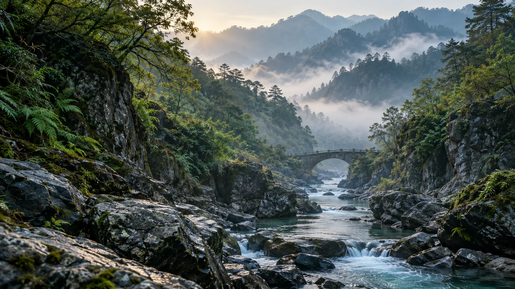
Begin with the “twenty-four streams”
A traditional catalogue, not a fixed survey
China’s Ministry of Culture and Tourism lists peaks, cliffs, streams, caves, pools, springs, wells and terraces among the landscape categories used at Wudang since at least the Yuan period. The number twenty-four therefore belongs to a long tradition of naming and ordering the mountain. It should not be treated as though it were a modern hydrographic inventory with permanently standardized boundaries.
The Chinese character jian (涧) can describe a mountain stream, ravine or the watercourse within it. Names may refer to water, terrain, a nearby temple or an episode remembered along a route. The parent guide to Wudang’s twenty-four streams is the right place to compare documented names; this article asks what such waterways did.
One watercourse can carry more than one name
A useful example is Jian River, which current Hubei documentation also calls Jiudu Ravine (九渡涧). It rises in the Wudang highlands, passes through the present Wudang town area and enters the Danjiangkou Reservoir. Calling it one of the traditional twenty-four streams connects historical landscape language with a living watershed, but does not make every historical name interchangeable with a single modern river segment.
Water access helped shape settlement
Close enough to use, far enough from danger
A 2025 peer-reviewed geospatial study of Ming-period Wudang temple sites compared altitude, slope, precipitation, river distance and other environmental variables. Its river-buffer analysis found notable clusters of sites roughly 200–400 metres and 600–800 metres from mapped waterways. The authors interpret this pattern as balancing water access with flood risk. The result is statistical rather than a rule for every palace or hermitage, but it confirms that water proximity deserves a place alongside ritual hierarchy, routes, terrain and visibility when we explain site selection.
Look across the mountain and the compromise becomes legible. A building may occupy a terrace above a ravine rather than its wet floor; a path may descend to cross water and rise again; roofs and courtyards must shed intense rain without directing it into foundations. The landscape was not passive background. It set conditions that planners, builders and residents continually answered. See also how Wudang’s terrain shaped temples and routes.
Streams made crossings into architecture
Tianjin Bridge and the Jiudu crossing
A Wudang Culture Research and Communication Center account, drawing on the Yuan-period inscription for Tianjin Bridge, dates its first construction to 1324. The bridge crossed Jiudu Ravine on an approach used by pilgrims. The same account explains that ordinary water could be forded, while heavy rain made the crossing wider, deeper and hazardous. A bridge answered a practical problem: it kept movement possible when the stream changed.
The crossing was also composed as a visual threshold. The bridge, valley, road and nearby religious architecture turned passage over water into a distinct stage of the ascent. That double role—hydraulic obstacle and meaningful approach—is characteristic of Wudang. Infrastructure could be useful without being visually indifferent.
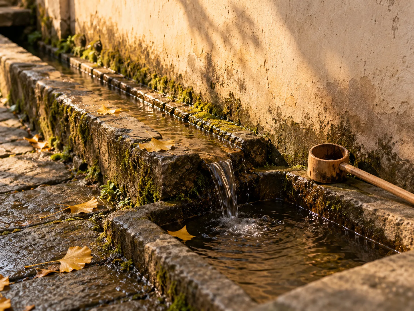
Inside a mountain compound, water meant work
Supply, drainage and fire protection
Temple communities needed dependable water for ordinary life, cleaning and maintenance. Timber buildings also required careful drainage and fire preparedness. UNESCO’s 2003 periodic report on the Wudang World Heritage property recorded plans to improve firefighting water sources and listed ditch dredging, leak sealing and roof-tile maintenance among routine conservation tasks. The document is a dated management snapshot, not proof that every historical courtyard used the same system, but it makes one principle clear: water had to be supplied, guided and kept away from vulnerable fabric.
When looking at a courtyard, distinguish collection from discharge. A basin, well or channel may serve a local function; a stone gutter or scupper may move stormwater onward. Do not assume that every water feature is ritual, or that clear-looking water is safe to drink. For the building-scale story, continue to Wudang temple roofs, courtyards and mountain drainage.
Holding soil as well as moving water
Water management extended beyond walls. Wudang researcher Yang Lizhi has connected stone embankments observed on erosion-prone slopes with the “repairing the mountain” (xiushan, 修山) work described in historical gazetteers. His interpretation is an argued reconstruction built from texts and field remains, and should be presented as such. The broader point is well supported: on steep ground, slowing runoff, retaining soil and maintaining paths were part of protecting the inhabited sacred landscape.
The old stream is also a modern watershed
Jian River now flows into a national water system
Water at Wudang cannot be frozen in the Ming dynasty. An August 2025 report from Hubei’s Department of Culture and Tourism describes Jian River flowing into the Danjiangkou Reservoir, a core source area for the central route of China’s South-to-North Water Diversion Project. It also documents contemporary wetland treatment, sewage control, river inspection and ecological restoration. These are modern interventions, not survivals of an ancient temple system.
The distinction is important. Historical bridges, traditional ravine names, heritage drainage and present-day watershed governance belong to different periods and institutions. They meet in the same terrain, but they should not be collapsed into one timeless story. Today, care for Wudang’s waters includes both cultural-heritage conservation and the downstream responsibilities of a major reservoir catchment.
How to read water responsibly on a visit
Six observations worth making
- Check the scale. Is the sign naming a spring, a ravine, a stream, a river or a reservoir? These are related but not identical features.
- Separate name from boundary. A historical place-name can survive even when a modern map divides the watercourse differently.
- Watch the route. Notice where stairs descend, bridges cross and gates appear; water often explains a turn in the pilgrimage path.
- Read the outlets. Roof edges, courtyard slopes, gutters, channels and retaining walls show how builders worked with rain.
- Respect changing conditions. Mountain streams rise quickly. Obey closures, keep out of channels and never cross floodwater.
- Leave water undisturbed. Do not drink untreated water, wash in temple basins, move stones or add offerings to streams.
Use philosophy as a lens, not a shortcut
The Daodejing’s chapter on the goodness of water has made water a powerful language for humility, benefit and low places in Daoist reading. That text can sharpen attention, but it does not prove that every bridge, spring or drain was designed as a coded philosophical symbol. Start with date, structure, terrain and use; then ask how religious interpretation may have shaped experience.
Wudang’s water landscape is richest when the layers remain visible: named ravine, physical watershed, route obstacle, daily resource, conservation problem and philosophical image. Follow the Wudang map and route guide for orientation, and let each crossing show how a sacred mountain was—and still is—made habitable.
Sources and further reading
- Yan et al., “How Do Natural Environmental Factors Influence the Spatial Patterns and Site Selection of Famous Mountain Temple Complexes in China?” Land 14 (2025).
- UNESCO, Periodic Report on the Ancient Building Complex in the Wudang Mountains (2003).
- Ministry of Culture and Tourism data service: Wudang Mountain landscape overview.
- Hubei Department of Culture and Tourism, Wudang water and landscape governance (13 August 2025).
- Wudang Culture Research and Communication Center, “Rainbow of the Immortal Bridge”.
- Wudang Culture Research and Communication Center, lecture report on historic “repairing the mountain” works.