How Water Leaves a Wudang Temple: Roofs, Courtyards and Mountain Drainage
武当宫观如何排水:屋面、院落与山地水路
Mountain architecture is easiest to admire by looking up, yet one of its most consequential stories runs downward. Rain strikes tiles, leaves the eaves, crosses a courtyard and must continue beyond platforms and retaining walls without lingering beside timber posts or foundations. At Wudang, where religious complexes occupy peaks, ravines, gullies and slopes, water management belongs to the architecture’s relationship with terrain. This guide follows the visible route of rain while distinguishing what a visitor can observe from what only archaeology or conservation records can establish.
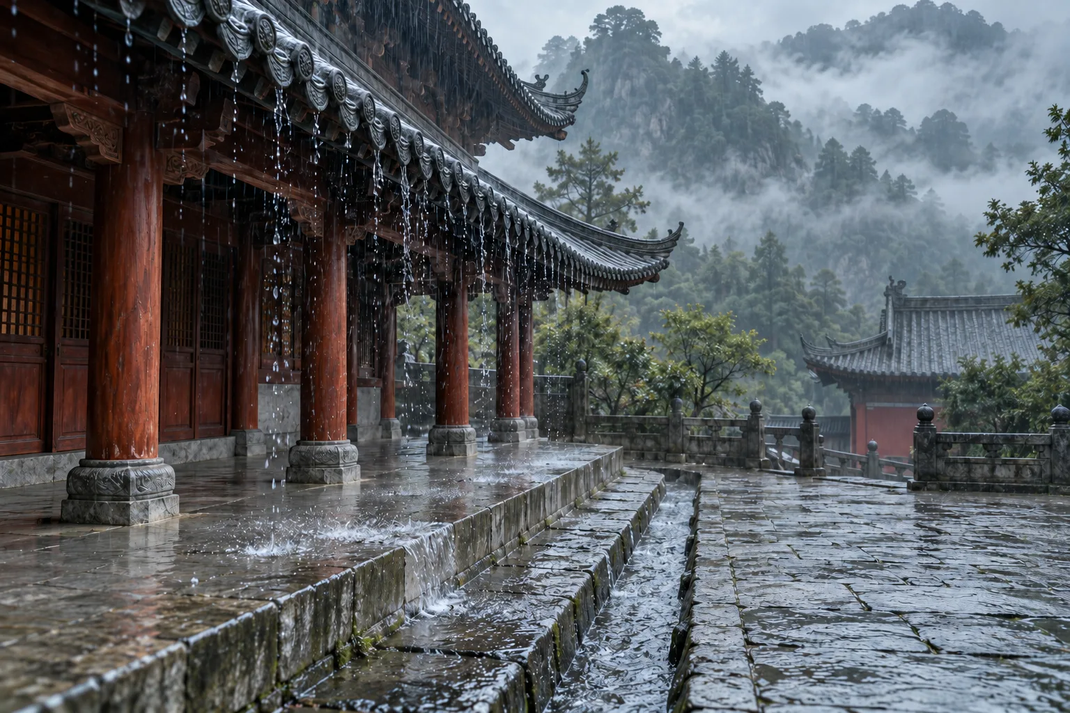
1. Follow Rain from Roof to Ground
Tiled slopes collect and shed water
A traditional pitched roof turns a broad field of rainfall into concentrated flow. Overlapping tiles guide water downslope, while ridges, valleys, curved profiles and roof junctions affect where it gathers and leaves. The geometry is therefore more than a silhouette. The site’s guide to reading Wudang roofs explains tiles, rank and repair; here the same roof can be read as the first stage in a longer water route.
Do not assume that every visible tile is ancient or that every repaired roof drains exactly as an earlier one did. A roof is a maintained assembly. Replaced tiles, patched valleys and altered paving may change how water moves, even when the overall architectural form remains legible.
Eaves create a line of impact
Projecting eaves throw water away from wall faces, but they also create a drip line where falling water meets the ground. Traditional Chinese buildings often use a paved or gravel strip beside the platform or wall. The Palace Museum glossary calls this feature sanshui (散水): a protective apron intended to keep rain from scouring the building base. It should not be confused with the whole drainage system; it manages the moment when roof water reaches the ground.
Look for a narrow band of different material, a slight fall away from the platform or a repaired edge beneath the eaves. Its present surface may not preserve the original material. The defensible observation is that the zone receives concentrated roof runoff; its date and historical configuration require documentation.
A courtyard is a graded surface
A courtyard that appears level may contain subtle falls. Paving joints, stone borders, shallow channels and thresholds can steer runoff toward an outlet. A 2026 peer-reviewed study of traditional Chinese courtyard drainage traces a long evolution from surface runoff to more systematic combinations of graded ground, open and covered conduits, and collection or discharge features. This general framework helps readers identify components, but it does not prove that every Wudang courtyard used the same plan.
Water also tests transitions: where stone meets packed earth, where a stair interrupts paving, or where a later repair meets older fabric. Dark staining or moss can suggest repeated moisture, but neither alone establishes the source, date or severity of a problem.
2. Move Water Across Mountain Architecture
Visible channels are only part of the route
Once water has crossed a roof edge and courtyard, it may enter an open gutter, pass through a stone opening, cross beneath a path or emerge farther downslope. A visitor can map visible inlets, channels and outlets, but should not invent a concealed connection between them. Covered drains can be altered, blocked or replaced, and an opening may serve a different purpose from the one it appears to have.
The useful question is not “Where is the single drain?” but “What sequence of surfaces and passages keeps flow moving away from vulnerable fabric?” On a large complex, several small routes may work in parallel rather than feed one monumental channel.
Terraces, stairs and retaining walls form one terrain system
Wudang builders did not place a flat diagram on a mountain. As the article on building on difficult ground shows, platforms and retaining walls convert steep ground into usable stages. Drainage must negotiate the same changes in level. A terrace may receive water from above, direct it along an edge, and release it where the next slope or channel can accept it.
Stairs can interrupt runoff, conduct it or protect a route beside them. Retaining walls need water kept from prolonged pressure and erosion, yet a surface view rarely reveals the wall’s internal construction. Read the visible arrangement—falls, outlets, joints and repairs—without diagnosing hidden structure.
Streams are the landscape context, not a convenient sewer
UNESCO describes the Wudang complexes as set among peaks, ravines, gullies and slopes. The Twenty-Four Streams guide likewise shows how named waters belong to the mountain’s cultural geography. Roof and courtyard runoff ultimately rejoins a wider catchment, but that does not mean every channel leads directly to a named stream or that historic drains can be treated as waste routes.
For a visitor, this wider view matters: the outlet at one terrace is not the end of the story. Water continues across slopes and paths, and poor disposal at one level can simply transfer erosion to the next.
3. What the Evidence at Wudang Can—and Cannot—Show
Wulong Palace preserves excavated drainage evidence
The Hubei Provincial Institute of Cultural Relics and Archaeology reports that excavation of a western compound at the Wulong Palace site exposed several terraced stages on the mountainside, together with roads, building remains, steps and drainage ditches. Finds were mainly Ming and Qing, with some earlier remains. This is direct evidence that drainage channels formed part of at least one documented Wudang architectural setting.
It is not a blueprint for every palace or temple. Excavation reveals a particular place, phase and preservation history. The value of the evidence lies in its specificity: it connects drainage with terraced construction rather than leaving water management as an abstract principle.
Standing fabric and excavated remains answer different questions
A standing courtyard lets us watch water move today. Archaeology can expose buried alignments, earlier surfaces and relationships between foundations and drains. Historical drawings, repair records and material study may add other layers. These sources should be compared, not collapsed. A functioning outlet in a restored courtyard is not automatically Ming fabric; an excavated ditch is not automatically proof of how a modern visitor route drains.
The guide to what is original and what was rebuilt offers a useful discipline: name the kind of evidence and the phase it supports. When the date is unknown, “visible channel” is more accurate than “Ming drain.”
Maintenance is part of the water story
UNESCO’s conservation account emphasizes planned maintenance and repair. That matters because water systems depend on continuity. A displaced tile, sediment-filled channel, cracked joint or blocked outlet can redirect flow. Conversely, a recent repair may deliberately protect older fabric. Condition therefore records both weathering and stewardship.
Visitors should never clear channels, lift covers, step beyond barriers or test a structure. Photograph from permitted routes, note the date and recent weather, and treat active works as conservation rather than as an inconvenience to the “authentic” view.
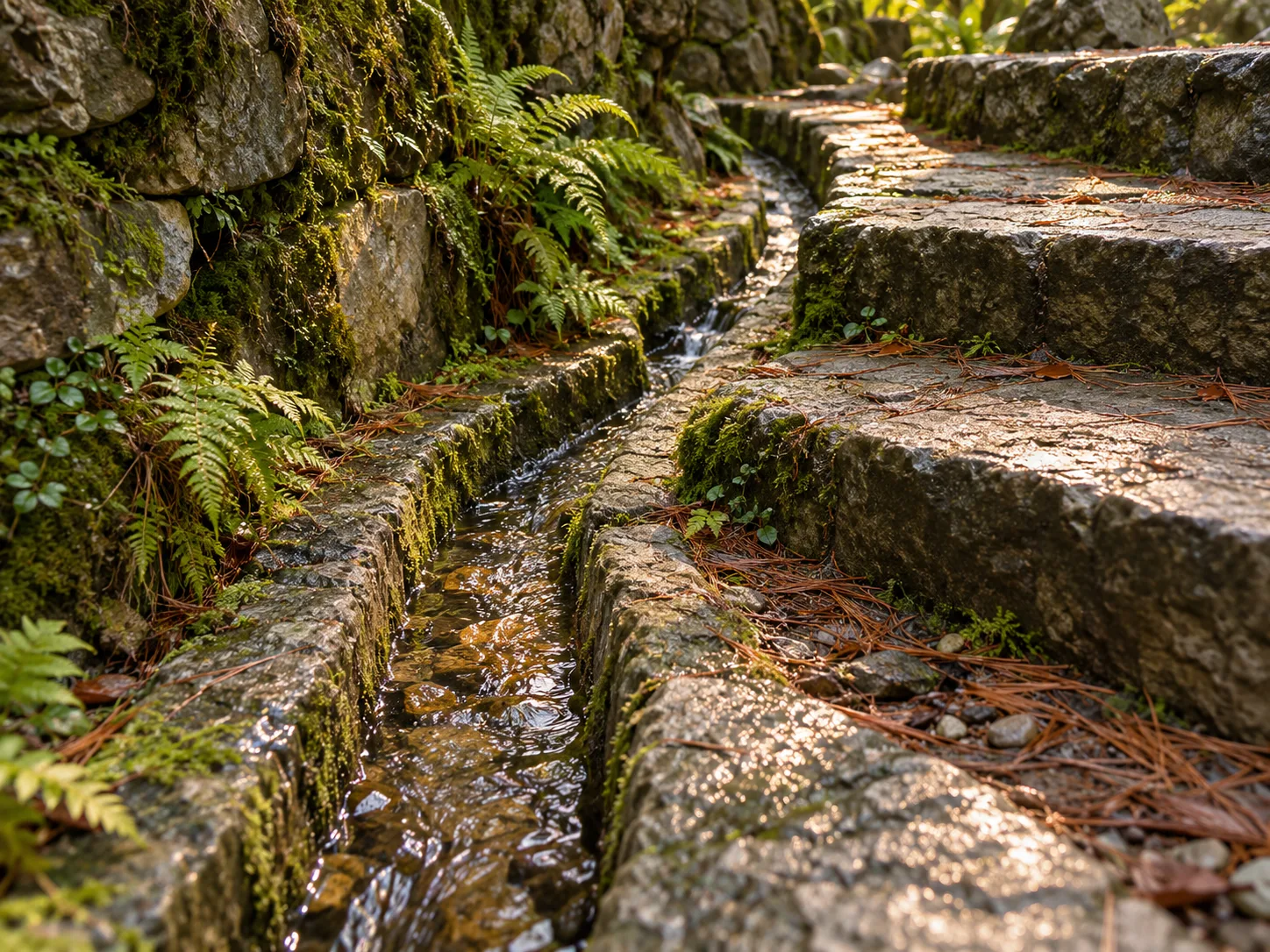
4. A Six-Step Method for Reading Rainwater on Site
Begin at the roof edge, not the drain
Choose one small, publicly visible area and work downstream. Start with roof pitch and junctions, then locate the eaves line, landing surface, courtyard fall, channel and outlet. This sequence prevents a dramatic stone gutter from being detached from the surfaces that feed it.
- Read the catchment. Identify which roof slopes and paved surfaces contribute water.
- Find the drop. Follow the eaves and note the impact zone, apron or receiving channel.
- Trace the fall. Use joints, edges and changes in level to infer only the visible direction of surface flow.
- Locate passages. Record open channels, scuppers, culverts and outlets without assuming unseen connections.
- Continue downslope. Ask where released water goes at the next terrace, path or retaining wall.
- Label the evidence. Separate present observation, published archaeology, conservation information and your own tentative interpretation.
Observe after rain, but do not diagnose
Recent rain makes flow paths easier to see: clean-washed strips, wet joints, ponding and active outlets may become visible. Conditions can also be slippery or restricted. Stay on open routes and never approach an edge or work area for a better view. One storm is a sample, not a full performance test. Wind direction, rainfall intensity, seasonal debris and recent maintenance all affect what appears.
A useful field note describes location, weather and observation before interpretation. “Water emerged from an opening at the east edge of the upper terrace” is stronger than “the ancient underground system failed,” unless archaeological and conservation evidence support the second claim.
Connect water to the whole architectural reading
Finally, return to the complex as an ordered landscape. Roof form, platform height, courtyard sequence, retaining walls and paths work together. Drainage is not a hidden technical afterthought: it is one way architecture negotiates gravity, weather and mountain terrain.
Continue with the overview of Wudang temple layout and architecture, then compare the documentary limits explained in Wudang World Heritage. The most reliable reading keeps beauty and infrastructure in the same frame while admitting where the evidence ends.
Research note: This guide draws on the Hubei Provincial Institute of Cultural Relics and Archaeology’s report on the Wulong Palace ruins; the Palace Museum glossary entry for sanshui (散水); Liu and Wang’s peer-reviewed study, “Historical Evolution of Traditional Chinese Courtyard Drainage Systems”; and UNESCO’s World Heritage record for the Ancient Building Complex in the Wudang Mountains. General Chinese architectural principles are used as a reading framework; Wudang-specific statements are limited to documented site evidence.